Need a Reset and a Refresh? The Best Walk on the South Coast to Blow The Cobwebs Away!
If your mind feels full, your energy flat, or you’re simply craving space to breathe again, the South Coast delivers it in the simplest way possible: on foot.
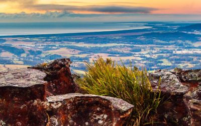
The Kiama Coast Walk is one of the most spectacular coastal walks in New South Wales — a 22km journey of headlands, beaches, basalt cliffs, rolling farmland, and ever-changing ocean views. It can be walked in full or enjoyed in sections, depending on how much time you want to spend reconnecting with nature.
This is not just a walk. It’s a reset button.
A Coastal Walk That Changes With Every Step
Kiama Coast Walk
What makes the Kiama Coast Walk so special is its contrast. One moment you’re passing through quiet suburban beaches, the next you’re standing on windswept cliffs watching waves crash into ancient rock formations. Then suddenly, you’re walking through open farmland with nothing but ocean and sky ahead of you.
It’s raw, varied, and constantly surprising — the kind of landscape that quietly clears your head without effort.
Stage 1: Minnamurra to Kiama Blowhole (8.4km | ~3 hours)
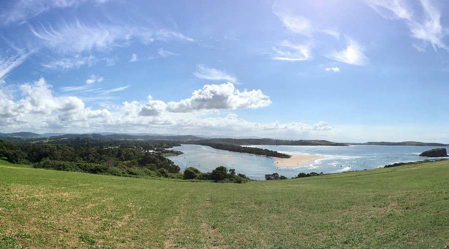
The walk begins near the mouth of the Minnamurra River, where calm waters and birdlife slowly give way to dramatic coastline.
This section is known for its geological beauty. You’ll pass Jones Beach, Cathedral Rocks, and the striking basalt formations at Bombo Headland — a surreal, almost sculptural landscape shaped by ancient volcanic activity.
The route eventually leads into Kiama, finishing at Kiama Blowhole Point, where the famous blowhole, harbour, and lighthouse create a perfect place to pause, refuel, and take in the view.
Stage 2: Kiama Blowhole to Loves Bay (5km | ~1.5–2 hours)
This middle section blends town and coastline in a beautifully gradual transition.
From Blowhole Point, the path winds past Surf Beach, Kendalls Beach, and the smaller coves that define Kiama’s coastline. The terrain alternates between paved paths, grassy headlands, and sandy edges, offering constant variety without ever feeling difficult.
As you pass Easts Beach and continue south, the atmosphere shifts. The built environment fades, the coastline opens up, and the walk begins to feel more remote and expansive.
By the time you reach Loves Bay, the pace naturally slows.
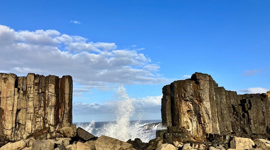
Rock Formations on the Kiama Coast Walk
Stage 3: Loves Bay to Gerringong (6km | ~2 hours)
This final stage feels like a different world entirely.
Clifftop farmland stretches toward the horizon, with uninterrupted ocean views and long, quiet tracks that feel far removed from everyday life. The South Coast railway appears occasionally, threading through tunnels carved into the escarpment more than a century ago.
This is the most exposed and atmospheric part of the walk — where wind, light, and weather shape the experience as much as the trail itself.
The walk finishes near Gerringong, where Werri Beach and local cafés offer the perfect place to rest, refresh, and reflect.
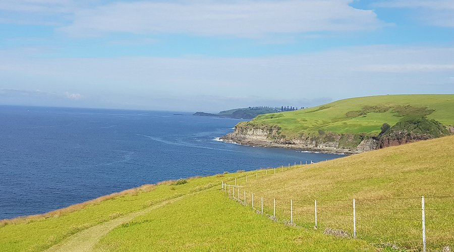
Rolling Hills of the South Coast Kiama Coast Walk
What to Bring
The Kiama Coast Walk is well signposted and accessible, but it’s still a proper coastal walk. Good shoes, sun protection, and water are essential, especially for the longer sections.
Weather can change quickly along exposed headlands, so it’s best to be prepared for sun, wind, or the occasional coastal shower.
Why This Walk Is Worth It
The Kiama Coast Walk isn’t just about distance or scenery — it’s about how it makes you feel.
By the end, most people don’t just feel like they’ve exercised. They feel reset. Clearer. Calmer. A little more grounded than when they started.
It’s one of those rare walks where the journey matters just as much as the destination.
Pair It With a Stay at Mt Hay Retreat
If you’re visiting the South Coast, this walk fits perfectly into a longer escape.
At Mt Hay Retreat, guests often pair coastal walks like this with slow mornings, long baths, and quiet afternoons overlooking the escarpment — a balance of movement and stillness that defines the region at its best.
Because sometimes the best kind of getaway isn’t about doing more.
It’s about feeling better.
For more information on walks to do in the Shoalhaven click Here!
Louise, Mt Hay Retreat.